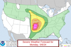
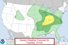
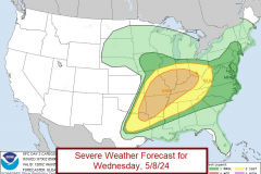
There are chances for severe thunderstorms in the Ozarks from today (Monday, 5/6) through Wednesday (5/8).
The greatest risks will be late tonight and in the afternoon and early evening on Wednesday.
For tonight, an active severe thunderstorm line will march into the Ozarks. Large hail, damaging winds and a tornado potential exists with this line. Current indications are for the line to arrive at the western Missouri border around midnight then continue to push through the Ozarks.
Tuesday will see more stable air in the wake of this line. However, some isolated severe cells are possible along the Missouri/Arkansas border. Imagine the yellow Slight Risk shown below extended more westward,
Wednesday has all of the Ozarks upgraded to an Enhance Risk (level 3 of 5). Thunderstorms are expected to form over the Ozarks becoming severe and increasing in strength and coverage as they move east.


