Between 3:30 and 3:45 p.m., many golfers captured a tornado moving over the Payne’s Valley golf course!
This is despite the fact that no watch, tornado or otherwise, was in effect. In fact, while the tornado was on the ground, there were no warnings of any kind in effect.
How is this possible?
Well, it can happen but it is rare. I was actually watching this yesterday afternoon trying to determine if severe weather was possible. My determination was it would not be widespread or even very likely.
This tornado is the product of unstable air close to the ground. It came out of a low-topped supercell storm. It would not be classified as a landspout in my view.
The environment also featured very low cloud bases, The sign for this is when the difference between the temperature and the dew point (dew point depression) is very low. This helps in tornado formation as any low-level rotation can ingested into the storm with more ease. The observations at the Branson Airport just a few miles south of the tornado’s location show dew point depressions ranging from 1-3 degrees in the few hours prior to the storm.
This was a low-topped supercell. The maximum height of this storm was on average about 22,000 ft., very low for a typical supercell storm! It was also a very small cell.
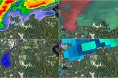
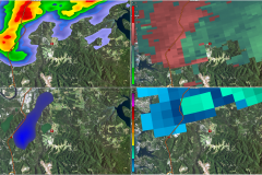
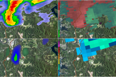
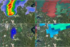
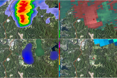
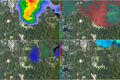
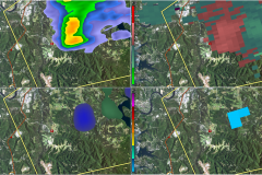
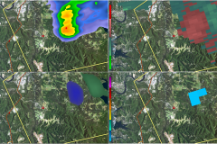
The circulation did show up on radar as shown below. In the images below, the red box marks the golf course. The four boxes are reflectivity UL (what everyone knows as the radar image), storm relative velocity UR (green toward, red away), normalized rotation LL (a way of finding tighter circulations) and storm elevation LR.
The first image shows evidence of a weak but tighter circulation just around highway 65 at 3:32 p.m. (LL). This area progressed ENE passing just west and north of the golf course. The image at 3:38 p.m. shows a pretty good circulation just north of the course.
I do not know the path length of intensity of this storm. The National Weather Service will conduct a survey of the storm to determine these parameters.

